Police when and where you need them!
We determine the best location for your police units, by day, by hour.

We determine the best location for your police units, by day, by hour.
We factor in RR crossings, traffic patterns—even the curvature of the roads–to ensure quickest response time.

We show you where to deploy ambulances to save more lives.
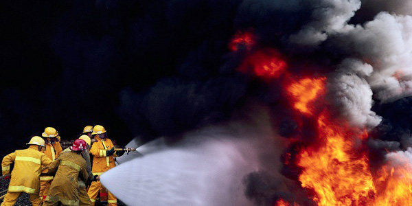
“Having (BeaconGIS) makes my life exponentially easier.” Fire Marshal J. Brad Hall, Spartanburg (SC) Fire Dept. Accreditation Manager
BeaconGIS provides expert technical analysis and recommendations to help communities optimize their emergency first-response performance across police, fire, and ambulance services.
For communities lacking funds and/or staff expertise, BeaconGIS provides objective, third-party expertise in technical analysis and planning for local governments and first response agencies. Whether you need comprehensive recommendations or customized services, BeaconGIS can help ease the burden and help restore optimum service levels, efficiently.
BeaconGIS also provides technical expertise to a variety of public safety and emergency management consultants for their project deliverables.
![]() We employ a broad array of technical analysis in assessing the current conditions governing the performance of emergency first response departments. This assessment establishes the “base case” for further analysis and recommendations.
We employ a broad array of technical analysis in assessing the current conditions governing the performance of emergency first response departments. This assessment establishes the “base case” for further analysis and recommendations.
![]() In this phase of analysis, the community rather than the first responder service is examined to identify areas of risk that, when properly addressed, can lead to significantly improved performance. Communities are dynamic and emergency response plans need to be updated continuously in order to adequately meet our citizens’ emergency response needs.
In this phase of analysis, the community rather than the first responder service is examined to identify areas of risk that, when properly addressed, can lead to significantly improved performance. Communities are dynamic and emergency response plans need to be updated continuously in order to adequately meet our citizens’ emergency response needs.
![]() The best conceived plans will remain effective for only so long due to the ever-changing community landscape. In this phase, additional tools are deployed to project the future needs resulting from the natural evolution of a community and the incremental changes that can be activated to maintain performance.
The best conceived plans will remain effective for only so long due to the ever-changing community landscape. In this phase, additional tools are deployed to project the future needs resulting from the natural evolution of a community and the incremental changes that can be activated to maintain performance.